As a focal point in the Cascade Range for almost a half million visitors each year, Crater Lake National Park is a place where beauty arose from cataclysmic events. Over seven millennia ago, the eruption and collapse of Mount Mazama generated such quantities of ash that it formed a distinct layer over several thousand square miles. The ash signifies North America's largest volcanic event of the Holocene epoch (10,000 years ago to present) and constitutes what is likely the most recognizable "time marker" in the stratigraphy of the Pacific Northwest.
Crater Lake is clear to a depth of 40 meters (about 130 feet), making it one of the world's clearest lakes. It is essentially a closed basin, with no visible inlets or outlets. The collapsed caldera left by Mount Mazama is roughly 6 by 9 km (3.7 by 5.5 miles), but what sets Crater Lake apart from every other lake in the United States is its depth. At 594 meters (about 1,949 feet), it is the second deepest lake in North America.
Crater Lake National Park exceeds the entire Oregon state park system in size by some 30,000 hectares (about 74,130 acres). Most people, however, visit only that tiny portion of the park that gives them a view of the blue waters. Even then, most visitors rarely linger for long. There are some people, however, who have long-standing ties to this place. For centuries, The Klamath and Modoc people, the Yahooskin Band of Paiute Indians, and the Cow Creek Band of Umpqua Indians have known what is today Crater Lake National Park. They now come to the park for ritual purposes and to visit traditional sites.
Congress designated Crater Lake National Park in 1902, with an original core of 60,400 hectares (about 149.250 acres); it is now 73,290 hectares (about 181,100 acres). The park was in the shape of a rectangle, which geologist J.S. Diller thought best encompassed landscape features associated with the climactic eruption of Mount Mazama. The name Mazama came from the mountaineering organization, Mazamas, started by William Gladstone Steel, who persistently campaigned for the establishment of the park.
Even though the park is emblematic of Oregon, there are years when there are more visitors from California than from Oregon. Annual visitation remains, as it has since the 1970s, at about a half million. This is partly the result of the park's distance from large urban areas. In addition, North Americans have taken shorter vacations during the past three decades, and the park has a somewhat limited appeal to foreign travelers, who make up only three percent of the total.
As part of the national park system, Crater Lake is probably most akin to Lassen Volcanic National Park in California. Both parks have a strong local and regional draw. Both are also examples of collapsed calderas (Mount Tehama at Lassen, much like the Yellowstone caldera, is geologically older and larger than the one left by Mount Mazama), though more recent work by the U.S. Geological Survey points to Crater Lake as a model for understanding how these features evolve.
Much as they did at Lassen and Yellowstone national parks, National Park Service designers created facilities at Crater Lake that are seemingly subordinate to the park setting. They evoked the character of the place through masonry of local stone and wood-frame construction that seems to grow from the ground. More subtle is the naturalistic landscaping intended to improve the larger scene by supplying a foreground of native plants and stone features as part of those places set aside for viewing the lake and surrounding peaks. Rim Village and Park Headquarters typify this type of development, which draws from a tradition that is traceable to ancient Greece and Rome but is more evident in private European estates during the eighteenth and nineteenth centuries. The heyday of this design in national parks came in the 1930s, yet "rustic architecture" is still part of the cultural tradition evident at Crater Lake.
Another tradition, one still alive at Crater Lake, gives the landscape associative value rather than scenic or educational interest. In an associative landscape, physical features suggest stories containing morals that reinforce group norms and identity. Activities such as logging and mining have been curtailed, and there are still opportunities for continued ritual use in places that are isolated from most people. With tourists concentrated in only a few developed areas, most of the park remains decidedly empty. In this respect, Crater Lake National Park continues to be a success.
-
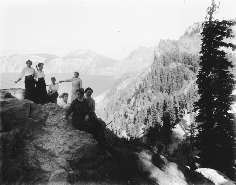
![Parkhurst Hotel group at Victor Rock, Crater Lake.]()
Crater Lake, women, bb000347 and OrHi 101922.
Parkhurst Hotel group at Victor Rock, Crater Lake. Photo by Kiser Studios, courtesy Oreg. Hist. Soc. Research Lib., bb000347
-
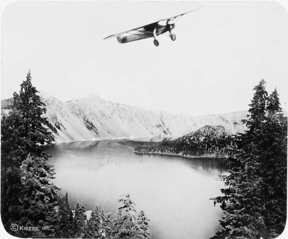
![Charles Lindbergh flies over Crater Lake.]()
Crater Lake, Lindburgh, Charles at, bb000370.
Charles Lindbergh flies over Crater Lake. Photo by Kiser Studios, courtesy Oreg. Hist. Soc. Research Lib., bb000370
-
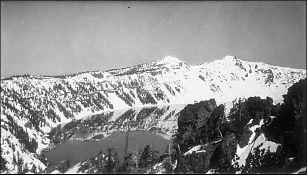
![Crater Lake in winter, 1925.]()
Crater Lake, winter, 1925, OrHi 093198.
Crater Lake in winter, 1925. Photo by John Maben, courtesy Oreg. Hist. Soc. Resarch Lib., OrHi 093198
-
![Watchman and Llao Rock formations at Crater Lake.]()
Crater Lake, Watchman and Llao Rock, OHQ cover, 1-02.
Watchman and Llao Rock formations at Crater Lake. Oreg. Hist. Soc. Research Lib.
-
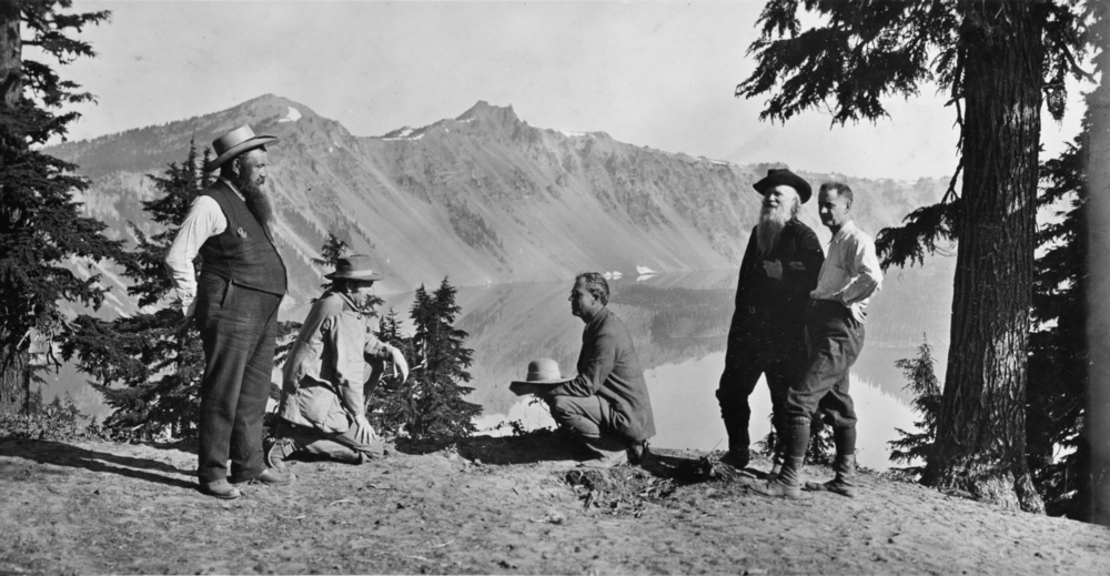
![William Steel, Phil Metscham, Dr. Hill, Senator Fulton, and Joaquin Miller at Crater Lake.]()
Crater Lake, Steel, Will G., and prominent Oregonians at, OrHi23615 and bb000360.
William Steel, Phil Metscham, Dr. Hill, Senator Fulton, and Joaquin Miller at Crater Lake. Photo by Kiser Studios, courtesy Oreg. Hist. Soc. Research Lib., bb000360
-
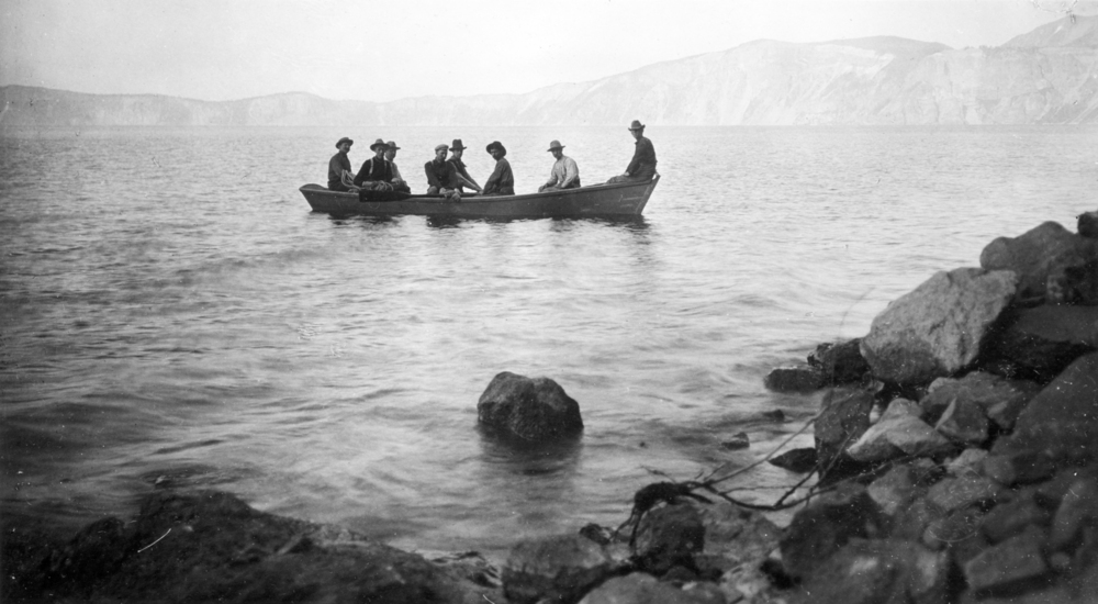
![William Steel, Phil Metscham, Dr. Hill, Senator Fulton, and Joaquin Miller on Crater Lake.]()
Crater Lake, Steel, Will, & others on boat, bb000363.
William Steel, Phil Metscham, Dr. Hill, Senator Fulton, and Joaquin Miller on Crater Lake. Photo by Kiser Studios, courtesy Oreg. Hist. Soc. Research Lib., bb000363
-
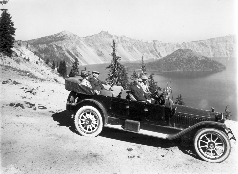
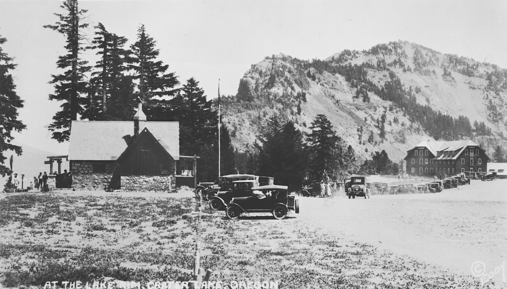
![Recreationists at Crater Lake.]()
Crater Lake, drivers at, OrHi 48833.
Recreationists at Crater Lake. Photo by Kiser Studios, courtesy Oreg. Hist. Soc. Research Lib., OrHi 48833
-
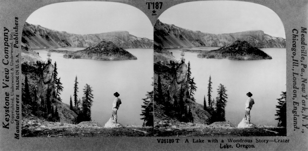
![Stereoscopic view of Crater Lake and Wizard Island, 1880s. Peter Britt likely took this photo.]()
Crater Lake, stereo, OrHi 97644.
Stereoscopic view of Crater Lake and Wizard Island, 1880s. Peter Britt likely took this photo. Oreg. Hist. Soc. Research Lib., OrHi 97644
-
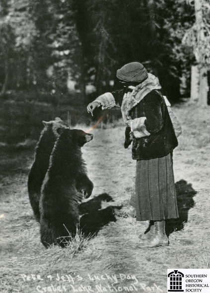
![Woman feeding bears at Crater Lake National Park, about 1920.]()
Crater Lake NP, woman feeding bears, ca 1920.
Woman feeding bears at Crater Lake National Park, about 1920. Southern Oreg. Hist. Soc., SOHS01i_20574
-
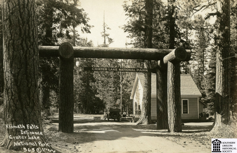
![South entrance to Crater Lake National Park, about 1925.]()
Crater Lake NP, S entrance, ca. 1925.
South entrance to Crater Lake National Park, about 1925. Photo Frank Patterson and Josephine Patterson, Southern Oreg. Hist. Soc., SOHS01i_15907
-
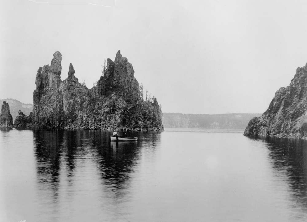
![Boating on Crater Lake.]()
Crater Lake, Gifford photo, OrHi neg,. GI10133, OHQ 1-02.
Boating on Crater Lake. Photo by Benjamin Gifford, courtesy Oreg. Hist. Soc. Research Lib., GI10133
-
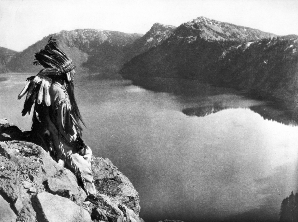
![A member of the Klamath tribe at Crater Lake.]()
Crater Lake, Klamath Indian at, OrHi 78069.
A member of the Klamath tribe at Crater Lake. Photo by Edward S. Curtis, courtesy Oreg. Hist. Soc. Research Lib., OrHi 78069
-
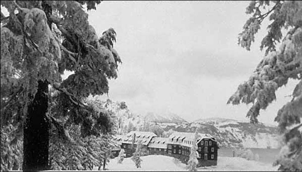
![Crater Lake Lodge, winter 1925.]()
Crater Lake Lodge, winter, 1925, OrHi 093200.
Crater Lake Lodge, winter 1925. Photo by John Maben, courtesy Oreg. Hist. Soc. Research Lib., OrHi 93200
-
![Photographer Fred Kiser's Studio near Crater Lake Lodge, 1920s.]()
Crater Lake, Kiser Studio at, OrHi 68539.
Photographer Fred Kiser's Studio near Crater Lake Lodge, 1920s. Photo by Kiser Studios, courtesy Oreg. Hist. Soc. Research Lib., OrHi 68539
-
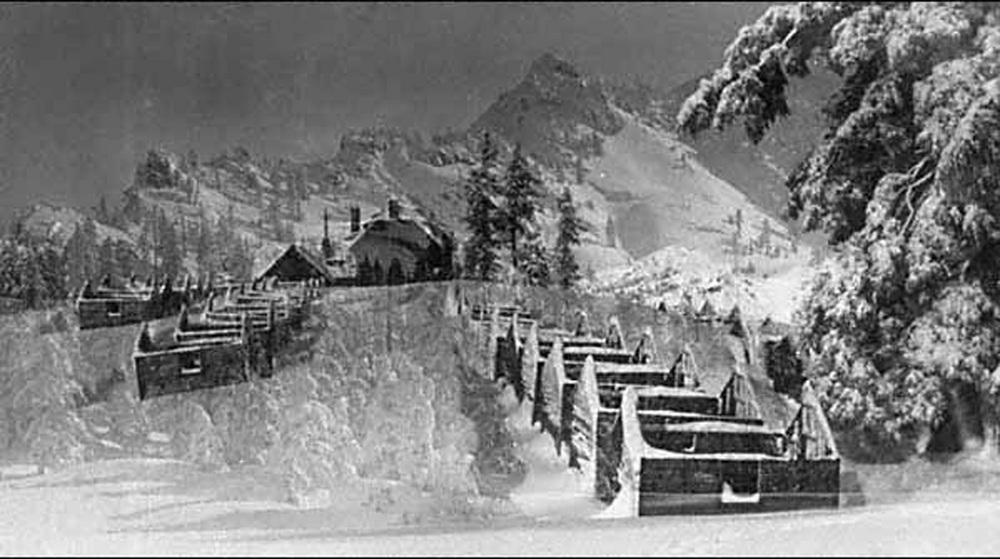
![Frame tent foundations at Crater Lake in the winter.]()
Crater Lake, foundations for tent cabins, 1925, OrHi 093199.
Frame tent foundations at Crater Lake in the winter. Photo by John Maben, courtesy Oreg. Hist. Soc. Research Lib., OrHi 093199

Related Entries
-
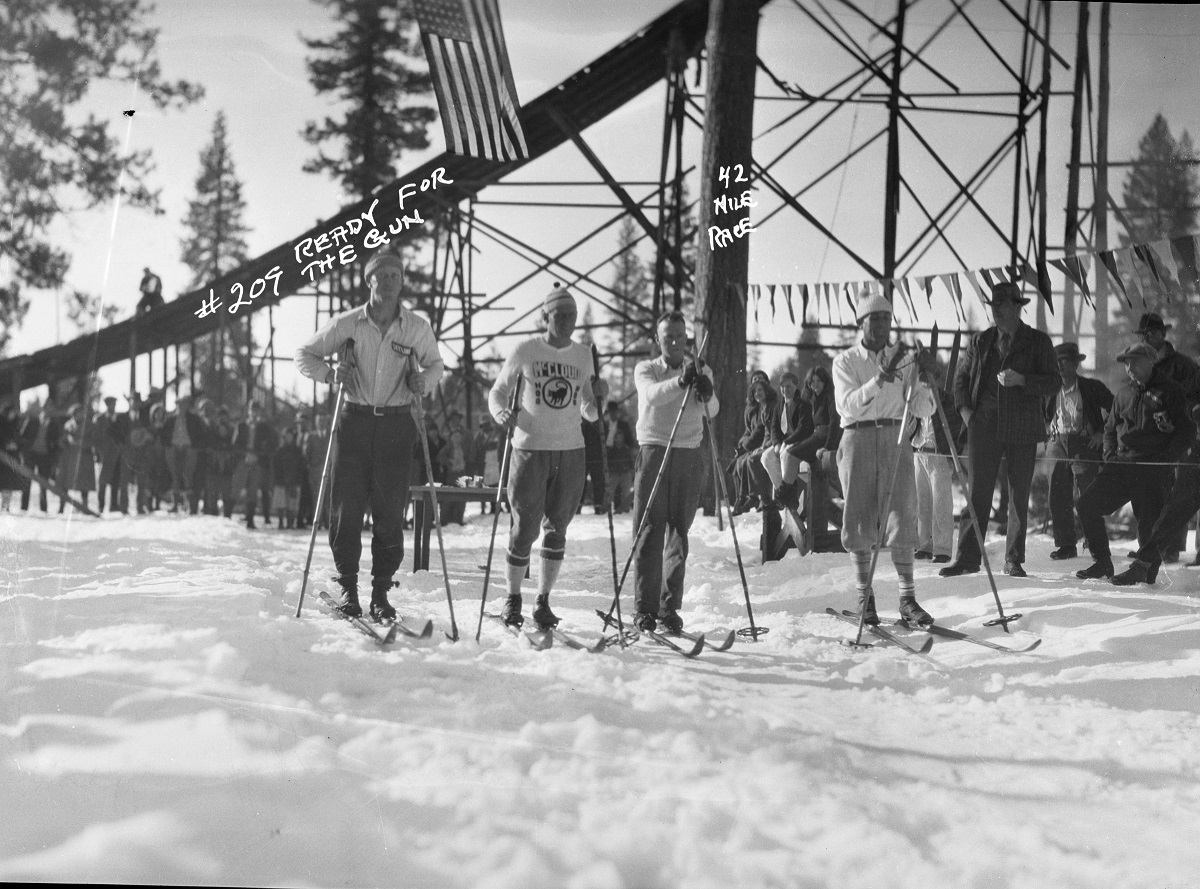
![Fort Klamath to Crater Lake Ski Race, 1927-1938]()
Fort Klamath to Crater Lake Ski Race, 1927-1938
In February 1927, the forty-two-mile, round-trip, cross-country ski rac…
-
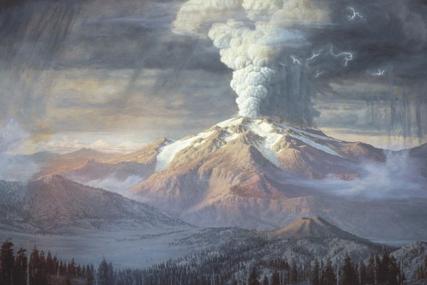
![Mount Mazama]()
Mount Mazama
Mount Mazama is located in the southern part of the Cascade Range, abou…
-
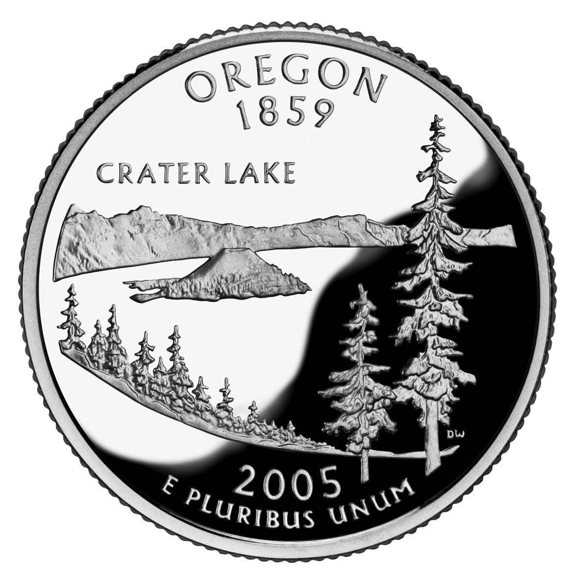
![Oregon Commemorative Quarter]()
Oregon Commemorative Quarter
In 2005, Crater Lake was featured on the Oregon State Quarter, part of …
-
![William G. Steel (1854-1934)]()
William G. Steel (1854-1934)
Born in Ohio on September 7, 1854, William Gladstone Steel was rai…

Related Historical Records
Map This on the Oregon History WayFinder
The Oregon History Wayfinder is an interactive map that identifies significant places, people, and events in Oregon history.
Further Reading
Atlas of Oregon Lakes. Online version. https://aol.research.pdx.edu/
Cressman, Luther S. The Sandal and the Caves. Corvallis: Oregon State University, 2005.
Harmon, Rick. Crater Lake National Park: A History. Corvallis: Oregon State University Press, 2002.
Johnson, Daniel M. Atlas of Oregon Lakes. Corvallis, Or. : Oregon State University Press, 1985.
Larson, Douglas W. "Probing the Depths of Crater Lake: A Century of Scientific Research." Oregon Historical Quarterly 100:3 (Fall 1999).
Larson, Gary L. et al., eds. Long-term Limnological Research and Monitoring at Crater Lake, Oregon. The Netherlands: Springer, 2007.
Mark, Stephen R. "Natural Heritage and the Maintenance of Iconic Stature: Crater Lake, Oregon, USA." In Lake Tourism: An Integrated Approach to Lacustrine Tourism Systems. Clevedon, England: Channel View, 2006.
Oregon Historical Society. Special Issue on Crater Lake National Park. Oregon Historical Quarterly, 103:1 (Spring 2002).